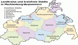
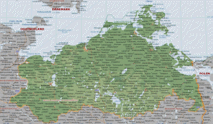
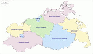
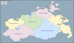
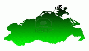
Mecklenburg-Vorpommern (Mecklenburg-Western Pomerania)
 |
 |
The state was established in 1945 after World War II through the merger of the historic regions of Mecklenburg and the Prussian Western Pomerania by the Soviet military administration in Allied-occupied Germany. It became part of the German Democratic Republic in 1949, but was dissolved in 1952 during administrative reforms and its territory divided into the districts of Rostock, Schwerin, and Neubrandenburg. A state called in German Mecklenburg-Vorpommern was re-established in 1990 following German reunification and became one of the new states of the Federal Republic of Germany.
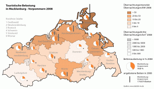
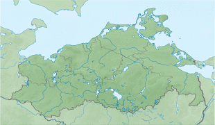
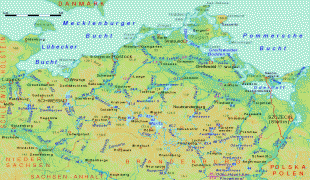
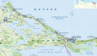
On the state's coastline on the Baltic Sea are many holiday resorts and much unspoilt nature, including the islands of Rügen, Usedom, and others, as well as the Mecklenburg Lake District, making the state one of Germany's leading tourist destinations. Three of Germany's fourteen national parks, as well as several hundred nature conservation areas, are in the state. The University of Rostock, founded in 1419, and the University of Greifswald, established in 1456, are among the oldest universities in Europe. In 2007, the 33rd G8 summit took place at the Grand Hotel Heiligendamm on the Mecklenburg Baltic coast during the chancellorship of Angela Merkel, a native of Mecklenburg-Vorpommern.
Due to its lengthy name, the state is often abbreviated as MV or (colloquially) shortened to MeckPomm. In English, it is usually named as "Mecklenburg-Western Pomerania". Inhabitants are called either Mecklenburger or Pomeranians, the combined form is never used.
The full name in German is pronounced. Sometimes, Mecklenburg is pronounced, because the digraph ck marks a preceding short vowel in High German. However, Mecklenburg is within the historical Low German language area, and the c appeared in its name during the period of transition to Standard, High German usage (Low German authors wrote the name Meklenborg or Męklenborg, depicting proper Low German pronunciation, which itself was a syncope of Middle Low German Mekelenborg). The introduction of the c is explained as follows: Either the c signals the stretched pronunciation of the preceding e (Dehnungs-c), or it signals the pronunciation of the subsequent k as an occlusive to prevent it from falsely being rendered as a fricative following a Low German trend. Another explanation is that the c comes from a mannerism in High German officialese of writing unnecessary letters, a so-called Letternhäufelung (, as was done sometimes in English with words such as "doubt"). The place name Vorpommern, at its base derives from West Slavic languages, with the prefix "po-" meaning along or at, and the base word "more" meaning sea — together "po more" means Land at the Sea — while the German prefix "vor-" denoted a closer location, and is the equivalent of the word "hither" in English.
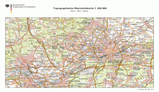
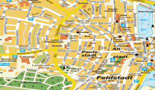
Map - Mecklenburg-Vorpommern (Mecklenburg-Western Pomerania)
Map


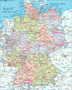


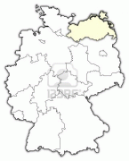
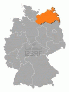
Country - Germany
 |
 |
| Flag of Germany | |
Various Germanic tribes have inhabited the northern parts of modern Germany since classical antiquity. A region named Germania was documented before AD 100. In 962, the Kingdom of Germany formed the bulk of the Holy Roman Empire. During the 16th century, northern German regions became the centre of the Protestant Reformation. Following the Napoleonic Wars and the dissolution of the Holy Roman Empire in 1806, the German Confederation was formed in 1815.
Currency / Language
| ISO | Currency | Symbol | Significant figures |
|---|---|---|---|
| EUR | Euro | € | 2 |
| ISO | Language |
|---|---|
| DE | German language |


